Unique technology
Efficient and reliable airborne leak detection
of gas pipelines using CHARM®
Areas of application
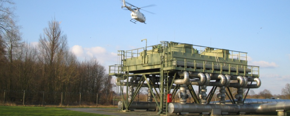
Gas leak detection of pipelines (pipeline monitoring)
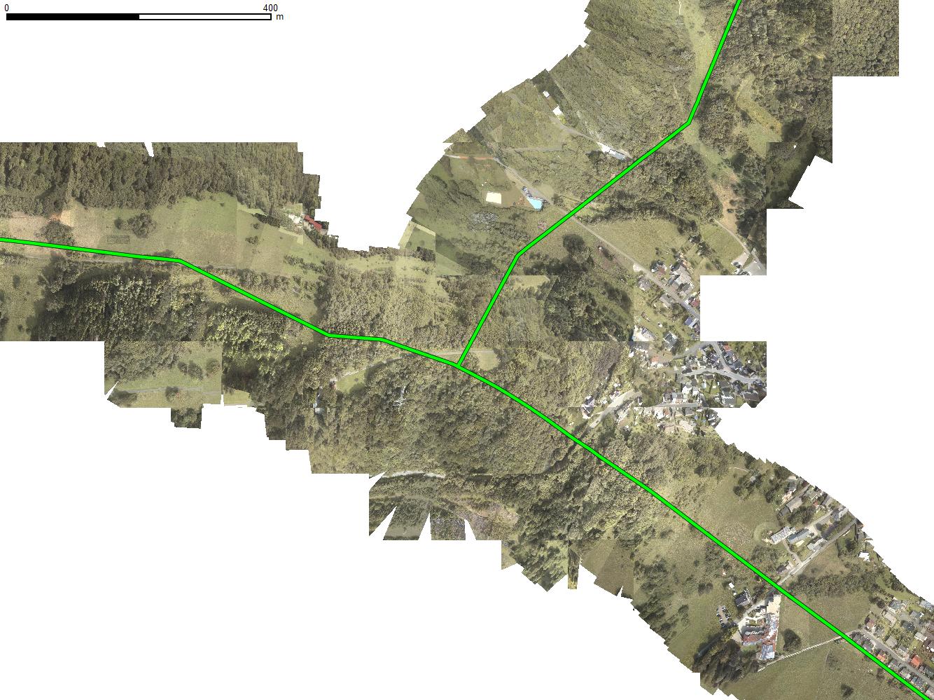
is CHARM’s® traditional area of application. Depending on the complexity of the network and the prevailing weather conditions, up to 500 km of pipeline can be surveyed daily. Due to the automatic beam guidance, the laser is always pointing to the pipeline centerline. This ensures that even the smallest quantities of gas are reliably detected. Critical leak indications can be sent to the customer in real time.
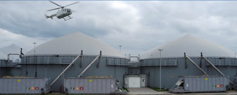
Emissions monitoring of methane-producing plants and facilities (fenceline monitoring)
makes it possible to quantify volatile gas, e.g. from biogas facilities or landfills. By flying a previously defined closed circuit around a biogas facility, the released quantities in the area can be determined using wind speed and the measured methane concentration profile.
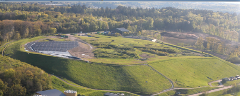
Surface area leak detection (full-field monitoring)
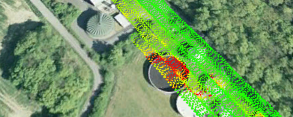
makes it possible to locate leaks in, for example, the cover of landfills or biogas facilities. During flight planning, the facility surface area is covered by parallel running virtual scan paths to ensure complete coverage of the total area. When flying over a landfill, both the flat and centrally located areas as well as the usually steep edges can thus be easily inspected.
Areas of application
Gas leak detection of pipelines (pipeline monitoring)
is CHARM’s® traditional area of application. Depending on the complexity of the network and the prevailing weather conditions, up to 500 km of pipeline can be surveyed daily. Due to the automatic beam guidance, the laser is always pointing to the pipeline centerline. This ensures that even the smallest quantities of gas are reliably detected. Critical leak indications can be sent to the customer in real time.
Emissions monitoring of methane-producing plants and facilities (fenceline monitoring)
makes it possible to quantify volatile gas, e.g. from biogas facilities or landfills. By flying a previously defined closed circuit around a biogas facility, the released quantities in the area can be determined using wind speed and the measured methane concentration profile.
Surface area leak detection (full-field monitoring)
makes it possible to locate leaks in, for example, the cover of landfills or biogas facilities. During flight planning, the facility surface area is covered by parallel running virtual scan paths to ensure complete coverage of the total area. When flying over a landfill, both the flat and centrally located areas as well as the usually steep edges can thus be easily inspected.
Data analysis
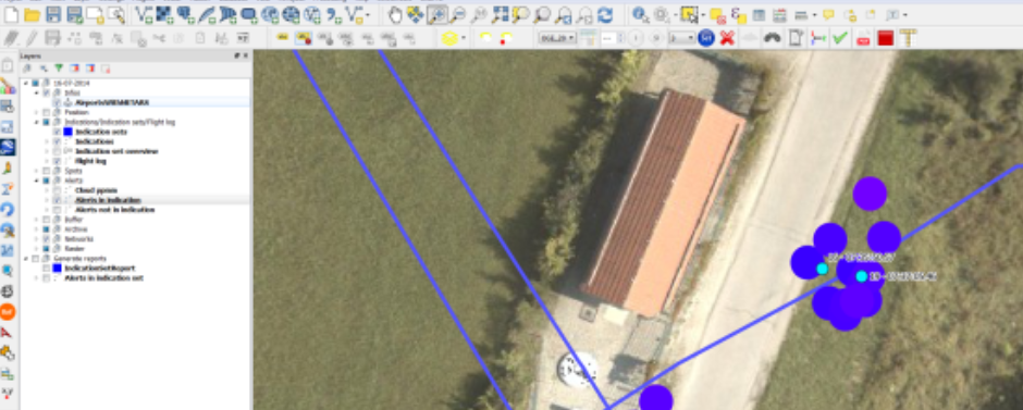
When flying over gas pipelines, the leak indications generated by CHARM® are evaluated and possible sources quantified. An experienced team analyses the indications and separates non-relevant data from data relevant to the client’s pipeline. The results are compiled in client-specific reports or integrated with the client’s geographic information system (GIS). The data includes georeferenced aerial photography of the gas exit point in addition to localized measurement data. This way, grid operators can minimize their time spent in the field to verify the gas indications.
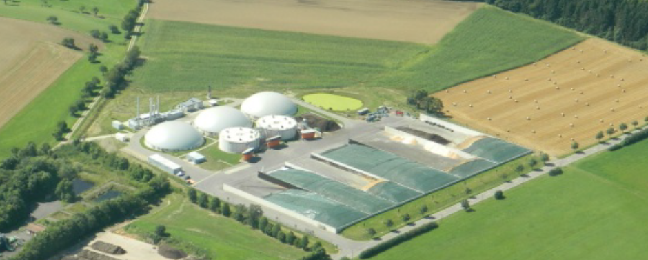
The theoretical background behind measuring the amount of emissions from methane-producing or methane-processing facilities is the continuity equation. For this evaluation, Adlares has developed specific software. The operator receives a detailed report on the released methane. If used regularly, facility safety, facility efficiency and public acceptance will increase.
Surface area leak detection is used, for instance, for landfills. CHARM® generates indications of possible leaks in the cover of a landfill. The facility is completely covered with measuring points, which means that no damaged areas are overlooked during evaluation. The data analysis gives the operator a tool for locating leaks in the facility and initiating mitigation measures.
Data analysis
When flying over gas pipelines, the leak indications generated by CHARM® are evaluated and possible sources quantified. An experienced team analyses the indications and separates non-relevant data from data relevant to the client’s pipeline. The results are compiled in client-specific reports or integrated with the client’s geographic information system (GIS). The data includes georeferenced aerial photography of the gas exit point in addition to localized measurement data. This way, grid operators can minimize their time spent in the field to verify the gas indications.
The theoretical background behind measuring the amount of emissions from methane-producing or methane-processing facilities is the continuity equation. For this evaluation, Adlares has developed specific software. The operator receives a detailed report on the released methane. If used regularly, facility safety, facility efficiency and public acceptance will increase.
Surface area leak detection is used, for instance, for landfills. CHARM® generates indications of possible leaks in the cover of a landfill. The facility is completely covered with measuring points, which means that no damaged areas are overlooked during evaluation. The data analysis gives the operator a tool for locating leaks in the facility and initiating mitigation measures.
Photography documentation
The CHARM® system is equipped with a high-resolution camera. During the flight, georeferenced photos are automatically taken of the pipeline right-of-way (ROW). The camera is always aligned with the laser over the pipeline centerline. The photography perspectives are ortho-rectified and can be adapted for integration with the client’s GIS system. At the customer’s request, other image recording systems (such as video, infrared, etc.) can also be integrated.
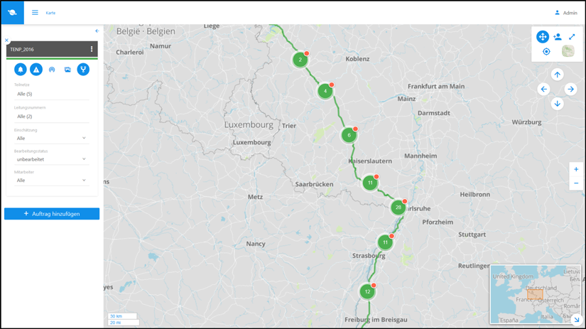
Web-GIS
Survey results are made available to the customer online in a password-protected area. The Web GIS can be used on a desktop computer with most web browsers (Internet Explorer, Firefox, Chrome) or as an app for Android and iOS mobile devices. Leak indications can be located, analyzed and documented directly in the field with a GPS-capable tablet.