
Gas pipelines carry enormous volumes of natural gas across Europe, often buried underground and spanning thousands of kilometres. Even small methane leaks from these networks can go unnoticed for extended periods, contributing to greenhouse gas emissions, creating safety hazards, and resulting in costly gas losses. Detecting those leaks reliably, quickly, and at scale is one of the most pressing challenges facing gas grid operators today. This article walks through how methane detection works, what the technology involves, and what regulations now require operators to do.
What is methane detection and why does it matter for gas pipelines?
Methane detection refers to the process of identifying the presence of methane gas escaping from pipelines, fittings, or other gas infrastructure. Because methane is colourless and odourless in its pure form, it cannot be spotted with the naked eye. Dedicated sensing technologies are needed to find leaks before they grow into serious problems.
For gas pipeline operators, reliable methane detection matters for several interconnected reasons:
- Safety: Methane accumulations in confined spaces or near ignition sources create explosion and fire risks.
- Environmental impact: Methane is a potent greenhouse gas, with a global warming potential many times higher than carbon dioxide over a 20-year period. Even small leaks across a large network add up to significant emissions.
- Commercial loss: Every cubic metre of gas that escapes undetected is revenue lost for the operator.
- Regulatory compliance: European legislation now mandates structured leak detection and repair programmes, with defined sensitivity thresholds and inspection intervals.
The earlier a leak is found, the cheaper and simpler the repair tends to be. That makes proactive, regular inspection far more cost-effective than waiting for a leak to become visible or to trigger an alarm.
How does airborne methane detection work?
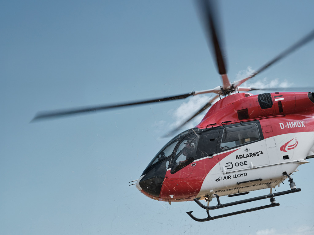
Airborne methane detection uses aircraft, typically helicopters, equipped with laser-based sensors to scan pipeline routes from above. The helicopter flies at low altitude along the pipeline corridor, and the sensor continuously fires laser pulses downward. When methane is present in the air column between the aircraft and the ground, it absorbs a specific portion of the laser energy. The system measures that absorption and converts it into a concentration reading, geo-referenced to a precise GPS location.
The key advantage of this approach is speed and coverage. A helicopter can survey hundreds of kilometres of pipeline in a single day, something that would take ground inspection teams weeks to cover on foot. At the same time, the sensor captures thousands of individual measurements per second, building a detailed picture of the pipeline route rather than a series of spot checks.
Operational parameters matter enormously in airborne detection. Flight altitude, airspeed, and wind conditions all influence the quality of the measurement. Certified airborne systems specify binding operational limits within which the system must be flown to guarantee reliable results. Flying outside those limits invalidates the survey data, which is why certification to a recognised technical standard is so important for operators who need defensible results.
What is the DIAL method for detecting methane remotely?
The Differential Absorption LIDAR (DIAL) method is the laser technique that underpins the most advanced airborne methane detection systems. LIDAR stands for Light Detection and Ranging, and the differential absorption variant applies it specifically to gas sensing.
DIAL works by emitting two laser pulses at slightly different wavelengths. One wavelength is tuned to a frequency that methane molecules absorb strongly. The other is tuned to a nearby frequency that methane does not absorb. By comparing the return signals from both pulses, the system can calculate how much methane is present in the air column the laser has passed through, isolating the methane signal from background noise and other atmospheric interference.
Operating in the mid-infrared range, around 3.3 micrometres, gives DIAL systems particularly strong sensitivity to methane, because this is where the molecule’s absorption signature is most pronounced. The result is a per-point detection limit that can reach below 1 ppm·m, meaning the system can detect extremely small concentrations of methane integrated over the path length of the laser beam.
DIAL is a remote sensing method, which means it requires no physical contact with the pipeline or the ground. The laser beam travels down through the atmosphere, reflects off the surface, and returns to the aircraft. This makes it well suited to inspecting buried pipelines where direct access to the pipe itself would require excavation.
How does airborne detection compare to ground-based pipeline inspection?
Ground-based inspection methods have been used for decades and remain part of the regulatory framework. They typically involve technicians walking the pipeline route with handheld instruments, or vehicle-mounted sensors driving along accessible roads near the pipeline. These approaches are thorough at a local level but are inherently slow and labour-intensive.
Airborne detection offers a fundamentally different trade-off between speed, coverage, and sensitivity. The comparison looks roughly like this:
- Survey speed: A helicopter survey can cover pipeline routes at speeds of up to 165 km/h, while on-foot surveys move at walking pace. For operators managing thousands of kilometres of network, this difference is decisive.
- Coverage: Airborne systems scan a continuous swath along the pipeline, capturing data at 1,000 measurements per second. Ground teams check discrete points or short segments.
- Sensitivity: Advanced airborne DIAL systems can detect surface methane concentrations as low as 300 ppm in a 2 by 2 metre area, which corresponds to the physical lower limit of detectable leaks from high-pressure steel pipelines. This level of sensitivity exceeds what many handheld instruments achieve under real operating conditions.
- Terrain independence: Airborne surveys are not restricted by fences, roads, or difficult terrain. They can inspect pipeline segments that are genuinely inaccessible to ground teams.
The two approaches are not mutually exclusive. Under the EU regulatory framework, aerial surveys function as a Stage 1 surface screening tool. When the airborne system flags an anomaly, ground teams follow up with a Stage 2 source confirmation, drilling a bar hole or excavating to measure directly at the pipe. This two-step model concentrates ground inspection effort where it is actually needed, rather than requiring technicians to walk every metre of every route.
For operators looking to understand the full range of available inspection approaches, our pipeline inspection services page provides a detailed overview of how airborne surveys fit into a complete LDAR programme.
What regulations require methane detection on gas pipelines?
The regulatory landscape for pipeline methane monitoring has changed significantly in recent years. EU Methane Regulation 2024/1787 is now the central legal framework governing leak detection and repair obligations for gas pipeline operators across Europe.
The regulation requires operators to establish and maintain formal Leak Detection and Repair (LDAR) programmes covering underground pipelines and above-ground infrastructure. The first Type-2 LDAR survey was required by August 2025. Key elements of the framework include:
- Two inspection types: Type-1 inspections require a detection limit of 17 g/h (or 7,000 ppm local concentration) and are suitable for optical gas imaging cameras and handheld instruments. Type-2 inspections require a more sensitive threshold of 5 g/h (or 1,000 ppm), which demands more sophisticated technology.
- Inspection intervals: Operators using Type-2 compliant technology can inspect underground pipelines once every three years, rather than more frequently. This longer interval is the regulatory reward for investing in higher-sensitivity equipment.
- Repair obligations: When a leak exceeding the relevant threshold is confirmed at the source during Stage 2 investigation, a repair obligation is triggered. All identified leaks must be recorded and records retained for at least 10 years.
- Best available technology: Until the forthcoming Implementing Act defines specific aerial detection thresholds, Article 14(7) of the regulation requires operators to use the best available technologies and detection techniques. Third-party certified systems satisfying DVGW G465-4-5 currently meet this standard.
The DVGW G465-4-5 standard, formerly known as G501, is the world’s only technical standard specifically for aerial inspection of underground gas pipelines. It sets binding requirements for detection probability, operational limits, and spatial coverage, making it the benchmark that regulators and operators can point to when demonstrating compliance.
How are methane leak survey results reported and acted on?
Collecting high-quality methane detection data is only useful if that data reaches the people who need to act on it in a clear, accessible format. Modern airborne survey programmes deliver results through secure digital platforms that allow operators to review findings on desktop and mobile devices.
A typical reporting workflow following an airborne survey includes:
- Geo-referenced anomaly reports: Each flagged location is tagged with GPS coordinates, with localisation accuracy better than 2 metres. Operators can see exactly where along the pipeline route an indication was recorded.
- Concentration data: Reports include the measured methane concentration at each anomaly point, helping operators prioritise which findings to investigate first.
- Pipeline tracking records: Certified systems maintain the scanning centreline within 0.5 metres of the pipeline, ensuring that every metre of the route has been covered and that the coverage can be demonstrated to regulators.
- Stage 2 dispatch: Ground teams use the anomaly reports to target their follow-up investigations, drilling bar holes or excavating only at the locations flagged by the aerial survey. This targeted approach significantly reduces the total effort required for source confirmation.
The quality and traceability of survey records matter as much as the detection itself. Operators must be able to demonstrate to regulators that their LDAR programme meets the required standards, which means the documentation trail from the aerial survey through to the repair record must be complete and verifiable.
How ADLARES helps with methane detection on gas pipelines
We have been providing airborne methane detection services commercially since 2008, and to date we have inspected over 250,000 km of gas pipelines across Europe. Our CHARM technology is the world’s only DVGW-certified aerial gas detection system, meeting Type-2 requirements under EU Methane Regulation 2024/1787 and independently verified to detect surface concentrations of 300 ppm in a 2 by 2 metre area under all certified flight conditions.
Here is what working with us looks like in practice:
- Fast, high-coverage surveys: Our helicopter-mounted CHARM system flies at speeds up to 165 km/h, covering large pipeline networks efficiently while capturing 1,000 measurements per second.
- Certified sensitivity: With a per-point detection limit below 1 ppm·m and surface sensitivity verified at 300 ppm, our system provides three times the sensitivity headroom required by the Type-2 threshold, ensuring reliable detection under all allowable conditions.
- Regulatory compliance: CHARM satisfies the EU Methane Regulation Type-2 standard and DVGW G465-4-5, giving operators the documentation they need to demonstrate compliance and qualify for three-year inspection intervals on underground pipelines.
- Actionable reporting: Survey results are delivered through a secure Web GIS platform, with geo-referenced anomaly reports accurate to better than 2 metres, ready for immediate Stage 2 follow-up by your ground teams.
- European experience: We work with gas grid operators across Europe and understand the practical and regulatory context in which pipeline operators are operating in 2026.
If you are planning your LDAR programme or want to understand how airborne detection fits your network, we would be glad to talk through the options with you. Visit our website to learn more about ADLARES and our CHARM technology, or get in touch with our team to discuss your specific pipeline inspection needs.
Dieser Inhalt wurde mithilfe von KI erstellt und kann Fehler enthalten.