
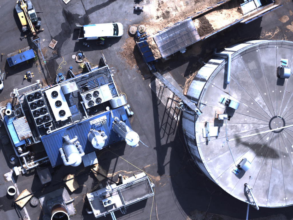
Landfills are one of the largest human-made sources of methane in the world. As organic waste decomposes underground, it produces landfill gas, a mixture that is roughly half methane by volume. Because methane is a potent greenhouse gas with a warming effect many times stronger than carbon dioxide over a 20-year period, understanding how much is escaping from these sites, and where, has become an urgent priority for regulators, operators, and environmental agencies alike. Measuring landfill methane emissions accurately is no longer just a matter of environmental best practice. It is increasingly a legal and reporting requirement across Europe and beyond.
What are methane emissions from landfills and why do they matter?
When organic material such as food waste, paper, and garden waste breaks down in a landfill without oxygen, the process produces landfill gas. Methane makes up a significant portion of that gas and, unlike carbon dioxide, it traps heat in the atmosphere with far greater intensity over shorter timeframes. Even small, uncontrolled releases from a landfill surface can contribute meaningfully to a site’s overall climate impact.
Beyond climate, methane from landfills poses safety risks. Uncontrolled migration of landfill gas can move through soil and accumulate in confined spaces near a site. For operators, regulators, and local communities, knowing the emission rate, the location of surface escape points, and the total flux from a site is essential for both safety management and environmental compliance. Reporting obligations under frameworks such as the EU Methane Regulation are driving a shift away from estimate-based accounting toward direct, source-level measurement of emissions.
What methods are used to measure landfill methane emissions?
Several techniques are used to quantify landfill methane, each suited to different scales of measurement and different levels of precision.
- Surface flux chambers: Portable enclosures placed on the landfill surface that capture gas emissions from a small area over a set period. Useful for point measurements but impractical for covering a large site comprehensively.
- Tracer gas dispersion: A known quantity of a tracer gas is released near the site, and downwind measurements are used to calculate total methane flux. This gives a site-wide figure but limited spatial detail.
- Ground-based optical gas imaging: Infrared cameras visualise gas plumes from the surface, helping operators locate visible leaks, though quantification requires additional steps.
- Vehicle-based mobile surveys: Instruments mounted on vehicles drive around or across a site, logging concentration data along a route. Coverage is faster than on-foot surveys but still limited by road access.
- Airborne remote sensing: Aircraft or helicopters equipped with laser-based sensors scan the entire landfill surface rapidly, producing a spatially resolved map of methane concentrations and enabling quantification of total site emissions.
Each method has trade-offs between spatial coverage, measurement resolution, speed, and cost. For large or complex sites, combining methods often produces the most complete picture.
How does airborne LIDAR technology detect methane over landfills?
Airborne LIDAR-based methane detection uses the principle that methane molecules absorb laser light at specific wavelengths. By emitting two laser pulses at slightly different wavelengths, one absorbed by methane and one not, the system measures the difference in reflected light intensity to calculate how much methane is present in the air column between the sensor and the ground. This technique is known as Differential Absorption LIDAR, or DIAL.
A helicopter equipped with this technology flies over the landfill at low altitude, typically between 100 and 150 metres, scanning the surface at high speed. With a sampling rate of 1,000 measurement points per second and a measurement spot of 80 to 150 centimetres in diameter, the system builds a dense grid of data points across the entire site. This grid-based approach is important because methane does not always escape directly above its underground source. Gas migrates through soil and the surface plume can be displaced laterally, meaning a single line of measurements along one path would miss real emission zones.
For landfill applications, the ability to quantify total site emissions in a single pass is particularly valuable. When supplementary wind data is collected on-site, the concentration measurements can be converted into emission flow rates expressed in kilograms per hour, giving operators a verified figure for regulatory reporting without requiring a separate ground survey.
What’s the difference between ground-based and aerial methane monitoring?
Ground-based monitoring methods, whether flux chambers, handheld detectors, or vehicle-mounted sensors, provide detailed, close-range measurements but are constrained by the physical limits of access and time. A large landfill covering tens of hectares would take days or weeks to survey comprehensively on foot, and the results would reflect different weather conditions at different points in the survey, making site-wide totals harder to interpret consistently.
Aerial monitoring covers the same area in a fraction of the time. A helicopter survey of a large landfill can be completed in a single flight, under consistent atmospheric conditions, producing a spatially coherent dataset. This consistency matters because methane readings at the surface are influenced by wind speed, atmospheric stability, and turbulence. Capturing the whole site in one session reduces the variability introduced by changing weather.
Ground-based methods remain valuable for follow-up investigation. When an aerial survey identifies an anomaly or a zone of elevated emissions, ground teams can focus their effort on that specific area rather than inspecting the entire site. This two-step approach, broad aerial screening followed by targeted ground confirmation, is both efficient and thorough. It mirrors the two-step LDAR methodology increasingly required under European methane regulations, where surface screening determines where ground investigation is needed.
How accurate are current landfill methane measurement techniques?
Accuracy in landfill methane measurement depends heavily on the method used and the conditions under which it is applied. One of the key challenges is that surface methane concentrations vary with factors outside the operator’s control, including wind speed and direction, atmospheric stability, soil permeability, and the depth at which gas is migrating. The same emission rate from the same location can produce very different surface readings on different days.
This is why expressing detection thresholds and emission rates in mass-flow units such as grams per hour or kilograms per hour is more meaningful than relying on parts-per-million concentration readings alone. A flow rate measured under controlled, reproducible conditions gives a consistent basis for comparison across surveys, sites, and technologies.
For airborne systems, independent verification provides an important benchmark. Certification against recognised standards, carried out at accredited test facilities under controlled release conditions, confirms that a system performs reliably across a range of environmental conditions and flight parameters. This kind of independently verified performance data is what operators need when submitting results for regulatory compliance or OGMP 2.0 Level 5 reporting.
How are landfill methane survey results reported and acted on?
A landfill methane survey produces two types of output: a spatial map of emission zones across the site and a quantified total emission figure for the site as a whole. Both are needed for effective management and regulatory reporting.
The spatial map allows site managers to prioritise remediation. Areas with elevated surface concentrations indicate where gas collection infrastructure may need maintenance, where cover material may be compromised, or where new collection wells may be required. GPS-tagged anomaly reports make it straightforward to direct ground teams to specific locations for further investigation or repair.
The total site emission figure feeds into environmental reporting obligations. Under frameworks such as the EU Methane Regulation and OGMP 2.0, operators are expected to move from estimate-based emission factors toward direct measurement. A verified, top-down site-level figure provides the evidence base for compliance reporting and, when compared with bottom-up source-level estimates, helps identify gaps or unaccounted emission sources. Survey data delivered through a secure web GIS platform allows operators to access, verify, and act on results efficiently, on desktop or mobile, without delays in data transfer.
How ADLARES helps with landfill methane monitoring
We combine airborne DIAL technology, independent certification, and a practical service model to give landfill operators a complete picture of their methane emissions in a single survey. Our CHARM technology is the world’s only DVGW-approved airborne gas remote detection system, with independently verified surface sensitivity and over 250,000 km of gas infrastructure surveyed across Europe since 2008.
For landfill sites specifically, here is what we provide:
- Full-site spatial mapping: A dense grid of measurement points covering the entire landfill surface, identifying emission zones with georeferenced accuracy better than 2 metres.
- Total site emission quantification: Conversion of concentration data into emission flow rates in kg/h using on-site wind measurements, sufficient for regulatory compliance without a separate ground survey.
- Targeted anomaly reports: GPS-tagged findings delivered via a secure web GIS platform, enabling ground teams to focus remediation efforts precisely where they are needed.
- Regulatory alignment: Survey outputs structured to support OGMP 2.0 Level 5 reporting and EU Methane Regulation compliance requirements.
Whether you need a baseline emission assessment, an annual monitoring survey, or data to support a specific reporting obligation, we can design a survey to fit your site and timeline. Get in touch with our team to discuss how airborne methane monitoring can work for your landfill.
Dieser Inhalt wurde mithilfe von KI erstellt und kann Fehler enthalten.