Wind-based flux calculations measure methane emission volumes by combining real-time wind speed and direction data with measured methane concentration values across a defined cross-section of the plume. Multiply the wind velocity by the concentration differential and the cross-sectional area, and you get an emission rate expressed as a volume or mass per unit of time. This method works for both point sources and distributed emitters, making it one of the most practical tools available for pipeline methane emissions quantification. The sections below unpack the key factors, how airborne surveys enable the calculation, and how results feed directly into regulatory compliance.
What factors does a wind-based flux calculation rely on?
A wind-based flux calculation relies on three core inputs: wind speed, wind direction, and methane concentration measured across a vertical or horizontal transect downwind of the source. All three must be captured simultaneously and at sufficient resolution to produce a reliable emission rate estimate.
In practice, the calculation integrates these inputs across the full width and depth of the methane plume. The wider or taller the plume, the more measurement points are needed to characterise it accurately. Key factors that influence the quality of the result include:
- Wind stability: Steady, laminar wind conditions produce cleaner plume shapes and more reliable flux estimates. Turbulent or rapidly shifting winds introduce uncertainty into both the concentration profile and the directional component.
- Measurement altitude and transect geometry: The transect must be positioned far enough downwind for the plume to be fully developed but close enough that dilution has not made concentrations difficult to resolve.
- Sensor sensitivity: The detection system must resolve small concentration differences above background levels, particularly for diffuse or low-rate emitters along pipeline routes.
- Atmospheric boundary layer conditions: Temperature inversions or convective mixing affect how methane disperses vertically, which in turn affects how the plume cross-section is interpreted.
When these factors are well-controlled, wind-based flux calculations can produce quantitative emission estimates that are comparable across surveys and sites, rather than simply flagging the presence of methane.
How does airborne methane detection enable flux calculations?
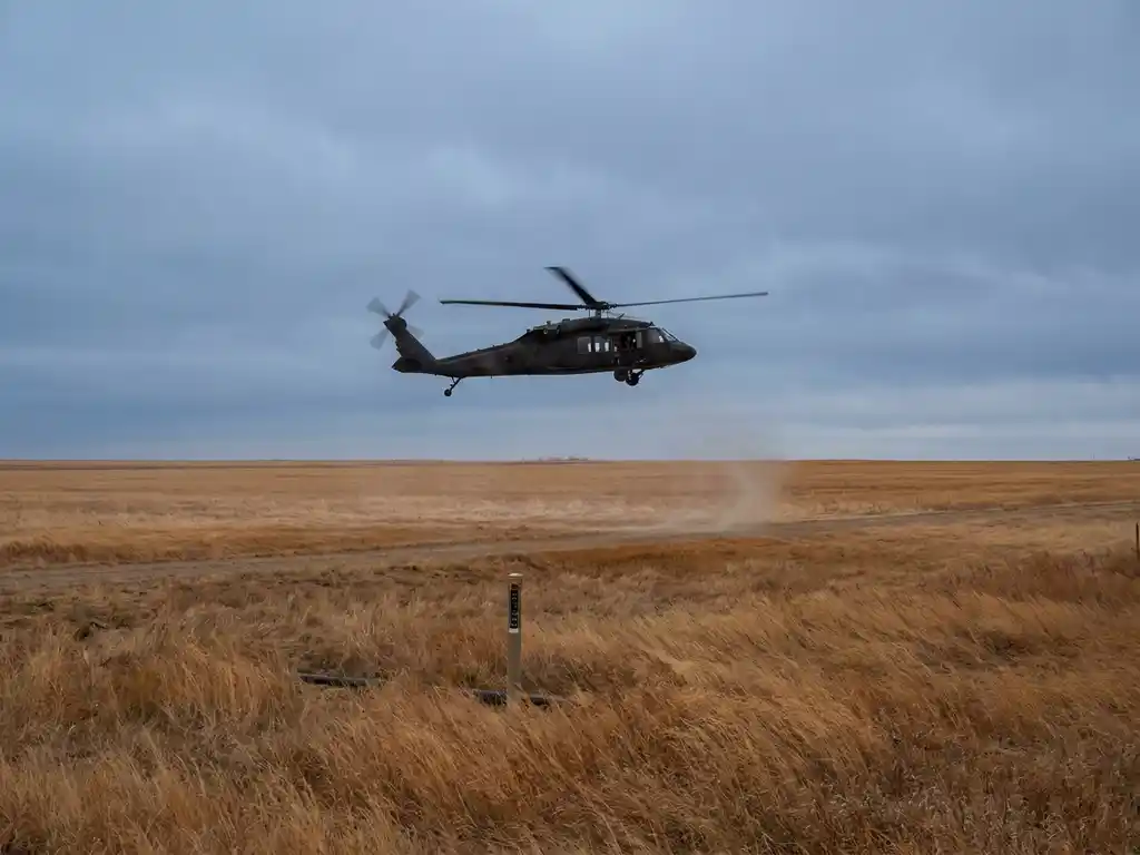
Airborne methane detection enables flux calculations by allowing a sensor-equipped aircraft to fly transects across a methane plume at a consistent altitude and speed, capturing spatially continuous concentration measurements that can be combined with onboard or co-located wind data to compute an integrated emission rate.
Ground-based approaches struggle with this because they typically capture point measurements at fixed locations, making it difficult to characterise the full cross-sectional profile of a plume. An aircraft flying at low altitude can sweep the entire plume width in a single pass, recording thousands of measurement points per second across the transect.
Laser-based remote sensing methods, such as Differential Absorption LIDAR (DIAL), are particularly well suited to this task. Rather than sampling air directly, they emit laser pulses at two wavelengths and measure how much light is absorbed by methane along the beam path. This produces a column-integrated concentration value for each measurement point, which maps directly onto the flux calculation framework without requiring assumptions about vertical mixing profiles.
The result is a spatially resolved picture of the methane plume that, when combined with wind vector data, yields a quantitative emission rate for the source below. This is the foundation of airborne LDAR methane quantification at the pipeline or facility scale.
How accurate are wind-based methane flux measurements?
Wind-based methane flux measurements are generally accurate to within a factor of two under favourable conditions, and can achieve tighter uncertainty bounds when wind conditions are stable and the measurement transect is well-positioned. Accuracy depends heavily on the quality and resolution of wind data, the sensitivity of the methane sensor, and how well the plume geometry is captured.
Several sources of uncertainty are worth understanding:
- Wind measurement uncertainty: Wind speed and direction at the measurement altitude may not perfectly represent conditions at the emission source, particularly in complex terrain or near structures that create local turbulence.
- Incomplete plume capture: If the aircraft transect does not cover the full vertical or horizontal extent of the plume, the flux estimate will be biased low.
- Background methane variability: Accurate subtraction of background methane levels is essential. Variability in background concentrations adds noise to the differential concentration used in the calculation.
- Atmospheric stability changes: Conditions that shift between passes can make it difficult to compare measurements taken at different times over the same source.
Despite these limitations, airborne flux surveys consistently outperform ground-based walking surveys in terms of spatial coverage and reproducibility at scale. For large pipeline networks, the trade-off between absolute precision and operational efficiency strongly favours the airborne approach, particularly when the goal is to identify and rank significant emitters rather than characterise every minor seep.
What’s the difference between flux calculation and leak detection?
Leak detection identifies whether methane is present and locates the probable source. Flux calculation quantifies how much methane is being emitted, expressed as a volume or mass emission rate. The two are complementary but serve different purposes: detection tells you where to look, while flux calculation tells you how serious the emission is.
In a standard LDAR pipeline inspection, the detection phase flags anomalies along the route. These anomalies are then investigated further to confirm whether a real leak exists and, if so, to estimate its emission rate. Flux calculation is the quantification step that follows detection.
This distinction matters for prioritisation. Two leaks detected at the same sensitivity threshold may have very different emission rates. A flux calculation allows operators to rank findings by severity, allocate repair resources efficiently, and report verified emission volumes rather than just a count of detected indications.
Regulatory frameworks increasingly require both. Detection alone satisfies the requirement to survey, but quantification satisfies the requirement to report and reduce emissions. As methane reporting obligations tighten across Europe, the ability to produce defensible emission rate estimates from survey data is becoming as important as detection sensitivity.
When should operators use airborne flux surveys over ground-based methods?
Operators should use airborne flux surveys over ground-based methods when covering large pipeline networks quickly, when terrain or access restrictions prevent walking surveys, or when the regulatory requirement is to quantify total emissions rather than simply detect and locate individual leaks.
Ground-based methods are well suited to urban distribution networks where technicians can walk routes systematically and access individual fittings for close-range inspection. They become impractical at transmission scale, where pipelines run through agricultural land, forests, or remote terrain over hundreds or thousands of kilometres.
Airborne surveys offer decisive advantages in several scenarios:
- High-pressure transmission pipelines: Long routes through varied terrain are surveyed far more efficiently from the air than on foot.
- Post-incident screening: After a suspected release event, an aerial survey can rapidly characterise the extent and rate of an emission across a wide area.
- Regulatory survey cycles: Where inspection intervals have been shortened by regulation, faster survey methods are needed to maintain compliance without proportionally increasing cost.
- Emission inventory development: Operators building a verified emissions inventory need quantified data across their full network, not just detection flags at individual points.
The choice is not always either/or. Many operators use airborne surveys for initial screening and prioritisation, then deploy ground crews to investigate and repair the highest-priority findings.
How do flux calculation results feed into EU methane regulation compliance?
Under EU Regulation 2024/1787, gas network operators are required not only to detect and repair methane leaks but to report verified emission data. Flux calculation results provide the quantified emission rates needed to meet reporting obligations, demonstrate emission reductions over time, and comply with the regulation’s Type 2 requirements for underground equipment.
The regulation introduced mandatory LDAR survey intervals that are significantly shorter than previous industry practice. For operators managing large networks, this means completing more surveys in the same or shorter timeframes. Airborne flux surveys address this directly by combining detection and quantification in a single pass at high survey speeds.
Flux data also feeds into the broader transparency framework the regulation establishes. Operators are expected to demonstrate that their reported emission figures are based on verifiable measurement methodologies, not estimates derived from default emission factors. A documented flux calculation, tied to a specific survey date and methodology, provides exactly this kind of defensible evidence.
Beyond compliance, quantified emission data enables operators to track performance over time, identify systemic issues in specific pipeline segments, and demonstrate progress toward methane reduction targets. As the regulatory environment continues to evolve, the ability to produce accurate, repeatable methane flux measurements will be a core operational competency for any gas network operator in Europe.
How ADLARES helps you quantify pipeline methane emissions
We provide end-to-end airborne methane emission quantification through our CHARM® technology, the world’s only DVGW-approved airborne gas remote detection system. Whether you are fulfilling LDAR obligations under EU Regulation 2024/1787 or building a verified emissions inventory, our surveys deliver the sensitivity, speed, and data quality you need.
- High-sensitivity detection and quantification: CHARM® can detect leakage rates from 150 l/h, ensuring even low-rate emitters are captured and quantified during a single survey pass.
- Rapid network coverage: Flying at up to 180 km/h at altitudes of 100 to 150 metres, we can cover large transmission and distribution networks within tight regulatory timeframes.
- EU Methane Regulation Type 2 compliance: Our surveys support compliance with underground equipment requirements, providing the documented, methodology-backed emission data regulators expect.
- Secure Web GIS delivery: Survey results are delivered through a secure, accessible platform so your team can verify findings, prioritise repairs, and export data for reporting immediately after the survey.
- Over 250,000 km of pipeline experience: We have inspected gas infrastructure for operators across Europe since 2008, giving us the operational depth to handle complex networks efficiently.
If you are preparing for your next LDAR survey cycle or need to build a defensible methane emissions baseline, contact ADLARES to discuss how our airborne flux surveys can meet your compliance and operational needs.