
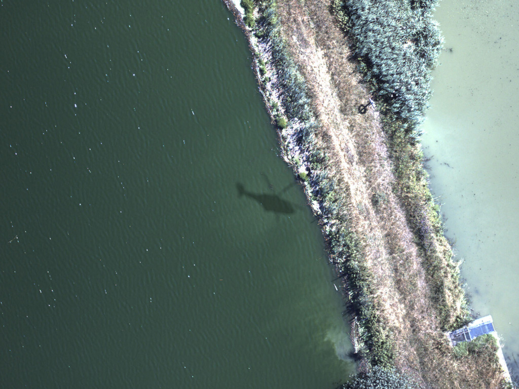
Airborne gas leak detection on a landfill cover works by flying a laser-equipped helicopter at low altitude across the site surface and measuring methane concentrations in the air column below the aircraft using the DIAL (Differential Absorption LIDAR) method. This approach allows operators to identify gas escaping through the landfill cap without any ground crew walking the surface. The sections below explain the technology, flight parameters, and how results are delivered and used.
What makes landfill cover gas detection different from pipeline surveys?
Landfill cover gas detection differs from pipeline surveys in both the target and the measurement geometry. With pipelines, the survey follows a linear route looking for point-source leaks from joints, valves, or damaged pipe sections. With a landfill, the entire surface area is the potential emission zone, and methane can escape diffusely across the cap at varying concentrations rather than from a single identifiable point.
This means the survey strategy must shift from corridor-based line scanning to full area coverage. The aircraft needs to fly a grid pattern across the landfill footprint, building up a spatially complete picture of methane concentrations at the surface. Leakage rates also tend to be lower per square metre than a pipeline rupture, which means the detection system must be sensitive enough to identify diffuse seepage from degraded or damaged cap sections.
Another key difference is the regulatory context. Landfill operators face obligations under environmental permitting regimes to demonstrate that their engineered covers are functioning correctly and that fugitive methane emissions remain within acceptable limits. This makes quantification, not just detection, an important output of any aerial landfill inspection.
How does airborne LIDAR detect methane across a landfill surface?
Airborne LIDAR detects methane on a landfill surface using the Differential Absorption LIDAR (DIAL) method, which fires two laser pulses of slightly different wavelengths toward the ground. One wavelength is tuned to a methane absorption band; the other is a reference. By comparing the reflected energy of both pulses, the system calculates how much methane is present in the air column between the aircraft and the surface below.
The measurement is entirely remote and passive from the ground perspective. No ground-based equipment, no surface probes, and no crew walking the cap are required. The laser pulses travel down through the atmosphere, reflect off the landfill surface, and return to the aircraft’s receiver. Because the system measures the integrated methane column concentration along each vertical path, it captures both surface emissions and near-surface accumulations caused by diffuse seepage through the cover material.
This makes LIDAR methane detection on landfills particularly well suited to identifying cap failures, areas of poor compaction, or zones where the gas collection infrastructure beneath the cover is underperforming. The spatial resolution of the measurement grid allows operators to pinpoint which sections of the landfill need remediation rather than conducting expensive and time-consuming manual surface flux chamber surveys across the entire site.
What flight parameters are used for landfill aerial surveys?
For landfill aerial surveys using DIAL-based airborne detection, the helicopter typically flies at altitudes between 100 and 150 metres above the surface at speeds of up to 180 km/h. At a measurement rate of 1,000 data points per second, the system builds a dense spatial grid of methane concentration readings across the entire landfill footprint in a single survey flight.
The grid pattern used for area coverage is different from the linear corridor flown over a pipeline. Flight lines are spaced to ensure full overlap of the measurement swath, so no part of the cap goes unsampled. Wind speed and direction at the time of the survey influence the detectability of diffuse emissions, and surveys are typically planned for conditions below 24 km/h wind speed to ensure reliable results.
Survey duration depends on the size of the landfill. A compact site can be covered in a single flight, while larger facilities may require multiple passes on the same day. Because the aircraft operates at low altitude, surveys must be coordinated with local aviation authorities and site operators, particularly on active landfills where heavy plant and vehicles are operating on the cap during working hours.
Can airborne detection quantify emissions, not just locate them?
Yes, airborne DIAL-based methane detection can quantify emissions from a landfill, not just locate them. The system measures the methane column concentration across the survey area, and when combined with wind speed, wind direction, and atmospheric conditions recorded during the flight, it is possible to calculate emission rates at the site level. This moves the result from a qualitative map of hot spots to a measurable emission figure.
Site-level emission quantification is increasingly important as environmental regulators move away from estimation-based reporting toward measurement-based approaches. For landfill operators, being able to demonstrate an independently measured emission figure rather than a modelled estimate adds credibility to environmental reports and supports compliance with permit conditions.
Quantification at the individual cap section level is also possible when the survey data is dense enough. This allows operators to rank areas of concern by emission magnitude, prioritising repair or cap reinforcement where the emission rate is highest rather than treating all anomalies as equally urgent. This kind of prioritisation is a practical operational benefit on large sites where resources for remediation are limited.
How are landfill survey results delivered and used by operators?
Landfill survey results from an airborne methane detection flight are delivered through a secure web-based GIS platform, accessible on both desktop and mobile devices. The platform presents the spatial distribution of methane concentrations across the surveyed area as an interactive map, with anomalies flagged and georeferenced so that ground teams can navigate directly to specific locations on the cap.
Operators use these results in several practical ways. First, the GIS data feeds directly into maintenance planning, identifying which cap sections require inspection, repair, or additional gas extraction infrastructure. Second, the survey report provides documented evidence of the landfill’s emission performance for regulatory submissions and environmental permit renewals. Third, repeat surveys over time allow operators to track whether remediation actions have been effective and whether the cap is performing as designed.
The georeferenced format also makes it straightforward to share data with third-party verifiers, environmental consultants, or regulators. Rather than exchanging static PDF reports, all stakeholders can access the same spatially accurate dataset, reducing the risk of misinterpretation and speeding up the verification process.
What certifications should an airborne landfill gas survey provider hold?
An airborne landfill gas survey provider should hold recognised technical certification for the detection system itself, as well as the necessary aviation authorisations for low-altitude commercial operations. The most significant technical certification for DIAL-based airborne methane detection in Europe is DVGW approval, which is the German technical standard for gas remote detection systems and the only internationally recognised approval of its kind for this technology.
DVGW certification is significant because it validates the sensitivity, accuracy, and reliability of the detection system against a defined technical standard rather than relying on the provider’s own performance claims. For landfill operators who need to demonstrate to regulators or insurers that their survey was conducted using a verified, fit-for-purpose method, a DVGW-approved system provides a defensible technical basis.
Beyond the detection system itself, providers should hold relevant aviation operating certificates for helicopter operations at low altitude, including any site-specific permissions required for surveying active landfill sites. Operators should also ask whether the provider’s data processing and reporting workflows are documented and auditable, since the integrity of the results chain from raw measurement to delivered GIS output matters as much as the quality of the sensor itself. Checking the technical team’s background and experience with landfill-specific surveys is also a reasonable due diligence step.
How ADLARES supports airborne landfill gas detection
We provide end-to-end aerial landfill gas monitoring using our CHARM® technology, the world’s only DVGW-approved airborne gas remote detection system. CHARM® uses the DIAL method to detect and quantify methane across the full surface area of a landfill cover in a single low-altitude helicopter survey, delivering results that are both technically defensible and immediately actionable.
Here is what we offer for landfill operators specifically:
- Full-area surface coverage: We fly a grid pattern across the entire landfill footprint, leaving no part of the cap unsampled, at speeds of up to 180 km/h and a measurement rate of 1,000 points per second.
- Emission quantification: Beyond locating anomalies, we provide site-level emission quantification, giving operators a measured figure they can use in regulatory reporting and permit compliance documentation.
- GIS-based results delivery: All survey data is delivered via our secure web GIS platform, georeferenced and accessible on desktop and mobile, so your ground teams can act on findings immediately.
- DVGW-approved methodology: Our CHARM® system is certified to the highest European technical standard for gas remote detection, providing a robust, auditable basis for environmental and regulatory submissions.
- Repeat survey capability: We support ongoing landfill gas monitoring programs, allowing you to track cap performance over time and verify that remediation work has achieved the intended reduction in fugitive emissions.
If you manage a landfill site and need a certified, high-sensitivity aerial survey to assess your cover’s performance or meet environmental permit requirements, contact our team to discuss how we can support your next survey.
Dieser Inhalt wurde mithilfe von KI erstellt und kann Fehler enthalten.