
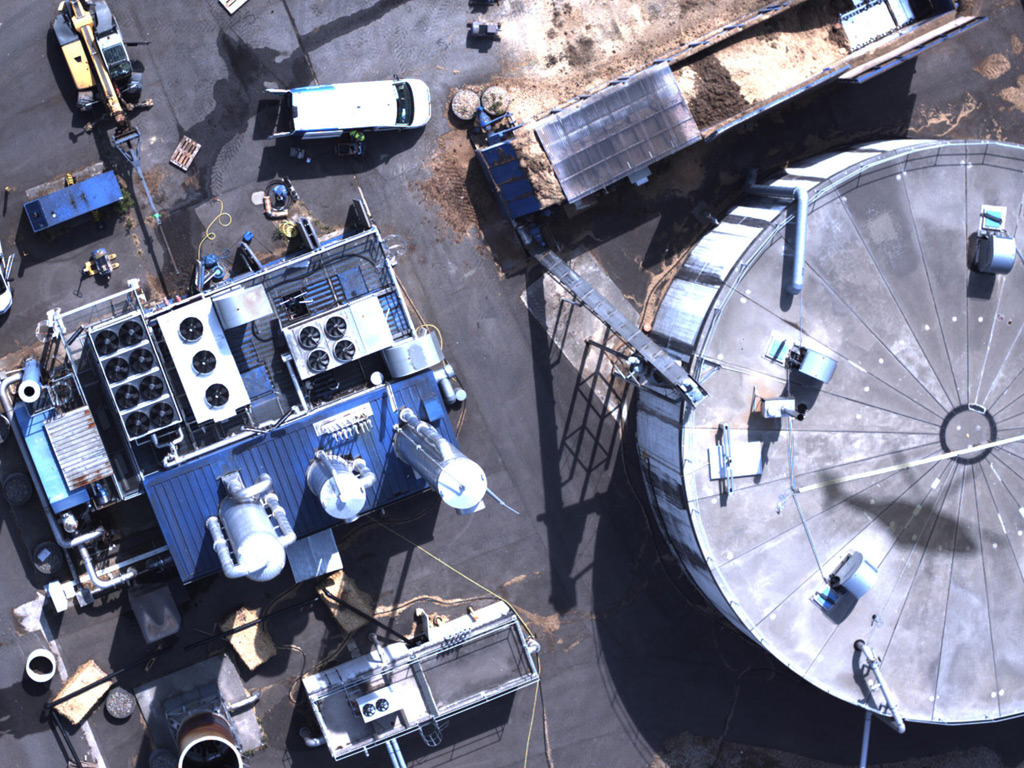
Airborne methane quantification at biogas facilities works by flying a laser-equipped aircraft over the site at low altitude and measuring how much methane gas is present in the air column below. The system detects and quantifies emissions without needing ground access, making it especially practical for large or complex sites. The sections below unpack how the technology works, what it measures, and when it makes sense to use it.
What data does airborne methane quantification actually produce?
Airborne methane quantification produces spatially resolved concentration data across the entire survey area, combined with emission rate estimates expressed in volume or mass per unit of time. The result is a georeferenced map of methane column concentrations, with flagged locations where emission rates exceed defined thresholds, all delivered through a digital platform.
Rather than a simple pass/fail indication, a well-executed airborne survey gives operators a layered dataset. You get the spatial footprint of each detected plume, the estimated leak rate at each source, and the total site-level emission figure. This combination is what makes airborne surveys genuinely useful for both compliance reporting and operational prioritisation.
Survey results are typically delivered through a secure Web GIS platform, where data can be viewed on desktop or mobile, filtered by emission intensity, and used to assign repair priorities. This format makes it straightforward to share findings across engineering, operations, and regulatory teams without any specialist GIS software.
How does the DIAL method measure methane from the air?
The Differential Absorption LIDAR (DIAL) method measures methane by emitting two laser pulses at slightly different wavelengths simultaneously. One wavelength is absorbed strongly by methane molecules; the other is not. By comparing the return signals from both pulses, the system calculates the concentration of methane in the air column between the aircraft and the ground with high precision.
The physics behind DIAL exploits a fundamental property of chemical compounds: each molecule absorbs light at specific wavelengths. Methane has a well-defined absorption signature, and DIAL uses that signature as a fingerprint. Because both pulses travel the same path through the same atmosphere at the same moment, environmental variables like humidity, aerosols, and surface reflectivity affect both equally and cancel out in the calculation. This makes the measurement inherently self-correcting.
In practice, the aircraft flies at altitudes between 100 and 150 metres, generating up to 1,000 measurement points per second. At survey speeds of up to 180 km/h, this produces a dense, continuous curtain of concentration data across the flight path. Leakage rates as low as 150 litres per hour can be registered, even at wind speeds up to 24 km/h, which is a sensitivity level that is difficult to match with handheld ground instruments across a large area.
What emission sources at a biogas plant can be detected from altitude?
Airborne methane detection at a biogas facility can identify emissions from digesters, gas storage domes, pipeline connections, pressure relief valves, flare systems, digestate handling areas, and upgrading equipment. Any component that releases methane into open air at a sufficient rate is potentially detectable, provided the plume rises or disperses into the air column the aircraft surveys.
Biogas plants are particularly well suited to airborne surveys because their emission sources are distributed across a defined site footprint rather than spread along linear infrastructure. A single flight pass can cover the entire facility, capturing the cumulative emission picture as well as isolating individual source contributions through plume dispersion modelling.
Sources that are often missed during manual walkovers, such as slow fugitive releases from membrane roofs, diffuse emissions from open digestate lagoons, or minor leaks at buried connections, are detectable because the airborne system integrates the signal across the full air column rather than relying on a technician being positioned directly above or beside the source.
How accurate is airborne methane quantification compared to ground-based methods?
Airborne methane quantification using DIAL is highly accurate for site-level emission totals and for detecting and ranking individual sources by emission rate. For pinpoint leak localisation at the component level, ground-based methods typically offer higher spatial resolution. The two approaches are complementary rather than competing, with airborne surveys excelling at scale and speed and ground methods excelling at precise source attribution.
Strengths of airborne quantification
The primary advantage of airborne measurement is coverage. A single survey flight can characterise the total methane emission budget of a biogas facility in one pass, without the variability introduced by multiple ground technicians working across different wind conditions and time windows. DIAL measurements are also independent of operator technique, since the laser system applies the same measurement physics consistently across every data point.
Where ground-based methods add value
Ground-based optical gas imaging cameras or sniffers are better suited to identifying exactly which valve seat, flange, or weld is leaking once the airborne survey has flagged an area of interest. They can also be used in enclosed spaces, buildings, and underground vaults where an aircraft cannot survey. A practical workflow combines the two: airborne quantification to screen the whole site and prioritise repair zones, followed by targeted ground inspection to confirm and locate individual component faults.
Does airborne methane quantification satisfy EU Methane Regulation requirements?
Yes, airborne methane quantification can satisfy requirements under EU Regulation 2024/1787, specifically for Type 2 LDAR surveys covering underground equipment, provided the system meets the sensitivity thresholds specified in the regulation. The regulation distinguishes between survey types, and high-sensitivity airborne systems are recognised as compliant tools for the relevant survey categories.
EU Regulation 2024/1787 entered into force in 2024 and directly affects operators of gas infrastructure, including biogas producers and upgrading facilities connected to the grid. The regulation mandates structured LDAR programmes with defined inspection intervals and minimum detection thresholds. For operators managing significant infrastructure footprints, meeting these obligations with ground-only methods can become logistically demanding as inspection frequencies increase.
Airborne surveys that meet the sensitivity requirements for Type 2 compliance allow operators to cover large areas efficiently within the shortened inspection windows the regulation introduces. Operators should verify that their chosen survey provider can demonstrate regulatory approval for their specific system, since not all airborne platforms carry the necessary certifications. You can review the available survey services to understand what certification and compliance documentation a qualified provider should be able to supply.
When should a biogas operator choose an airborne survey over a site walkover?
A biogas operator should choose an airborne survey when the primary objective is site-level emission quantification, regulatory LDAR compliance across a large footprint, or rapid screening of multiple facilities within a single campaign. A site walkover is more appropriate when the goal is detailed component-level inspection of a small, well-defined area where ground access is straightforward.
The decision often comes down to what question you are trying to answer. If you need to know the total methane emission rate of your facility for regulatory reporting or carbon accounting, an airborne quantification survey gives you a defensible, georeferenced figure in a single operation. If you already know a specific valve bank or compressor skid is suspect, a ground inspector with an optical gas imaging camera will find the fault faster.
Practical triggers for choosing an airborne survey include:
- Preparing for or demonstrating compliance with EU Methane Regulation Type 2 requirements
- Screening a site before a planned maintenance shutdown to prioritise repair work
- Quantifying total site emissions for environmental reporting or carbon offset programmes
- Surveying multiple biogas facilities across a region within a short operational window
- Investigating a suspected diffuse emission source that ground teams have been unable to locate
Airborne surveys are also considerably less disruptive to ongoing plant operations than comprehensive manual walkovers, since no ground access or production interruptions are required during the flight itself.
How ADLARES supports methane emission quantification at biogas facilities
We provide airborne methane emission quantification for biogas facilities using our CHARM® technology, the world’s only DVGW-approved airborne gas remote detection system. CHARM® uses the DIAL method to deliver high-sensitivity, site-level emission data in a single survey flight, with results accessible through our secure Web GIS platform.
Here is what working with us looks like in practice:
- Full site coverage in one pass: Our helicopter surveys cover your entire facility at up to 180 km/h, detecting leakage rates from 150 l/h without disrupting plant operations.
- EU Methane Regulation compliance: CHARM® meets the sensitivity requirements for Type 2 LDAR surveys under EU Regulation 2024/1787, giving you a documented, compliant inspection record.
- Georeferenced results via Web GIS: Survey findings are delivered through a secure online platform, accessible on desktop and mobile, so your engineering and compliance teams can act on data immediately.
- Emission quantification for reporting: We provide site-level emission rate figures suitable for regulatory submissions, carbon accounting, and internal environmental targets.
- Over 250,000 km of pipeline inspection experience: Our track record across European gas infrastructure means we bring proven methodology and regulatory familiarity to every biogas site survey.
If you operate a biogas facility and want to understand your methane emission profile or prepare for EU Methane Regulation compliance, get in touch with our team to discuss a survey that fits your site and timeline.
Dieser Inhalt wurde mithilfe von KI erstellt und kann Fehler enthalten.