
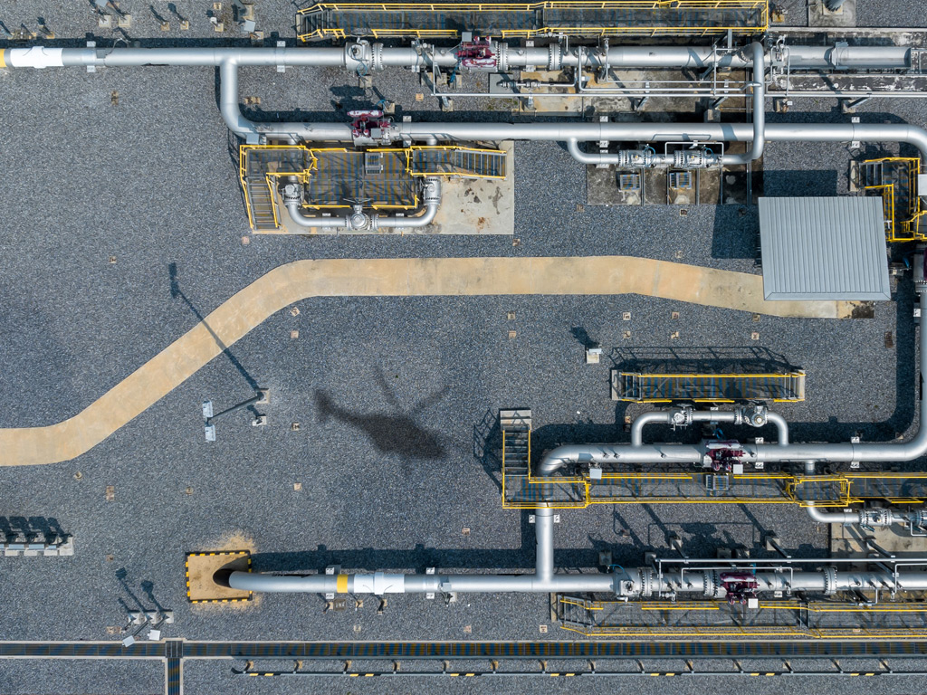
Aerial and ground-based leak surveys differ primarily in speed, coverage, and detection methods. Aerial surveys use laser-based remote sensing technology to scan large stretches of pipeline from a helicopter, covering hundreds of kilometers per day. Ground patrols use portable gas detectors carried by technicians on foot or in vehicles, covering far less distance but allowing close-up investigation of specific sites. The sections below unpack the key differences across coverage, detection, sensitivity, and regulatory compliance.
Which method covers more pipeline distance per day?
Aerial surveys cover significantly more pipeline distance per day than ground-based patrols. A helicopter-based system can inspect several hundred kilometers of pipeline in a single day, while a ground crew using portable detectors typically covers only a fraction of that distance, depending on terrain, access, and the density of infrastructure along the route.
This gap in throughput has real operational consequences for large transmission and distribution networks. For operators managing thousands of kilometers of buried or above-ground pipelines, completing a full network survey within a regulatory reporting cycle is simply not feasible using ground patrols alone. Aerial surveys compress that timeline dramatically, making it practical to inspect an entire network in a matter of days rather than weeks or months.
Ground patrols remain valuable for targeted reinspection of flagged locations, but as a primary survey method across wide-area pipeline inspection programs, they cannot match the throughput of airborne systems.
How does each method detect methane leaks?
Ground-based surveys detect methane by measuring gas concentrations at or near ground level using handheld or vehicle-mounted sensors. Technicians walk or drive along the pipeline route and look for elevated gas readings that indicate a potential leak below or nearby. Aerial surveys use remote laser sensing to detect methane columns in the air above the pipeline without requiring physical proximity to the source.
The most advanced airborne systems use the Differential Absorption LIDAR (DIAL) method. This technique emits two laser pulses at different wavelengths, one tuned to a methane absorption band and one used as a reference. By comparing how each pulse is absorbed as it travels through the atmosphere and reflects back to the sensor, the system can precisely quantify the concentration of methane present in the air column below the aircraft.
Ground-based methods are effective at confirming leaks once a general area has been identified, but they are reactive and slow. Airborne DIAL detection is proactive and wide-area, scanning the pipeline corridor continuously as the helicopter flies at operational speed.
What leak sizes can aerial surveys reliably detect?
Modern airborne gas detection systems can reliably detect leaks as low as 150 liters per hour under typical field conditions. This level of sensitivity is sufficient to identify small, slow leaks that would otherwise go undetected during routine ground patrols, particularly where access to the pipeline corridor is restricted or where leaks disperse quickly due to wind.
Detection performance depends on a few key variables: wind speed, flight altitude, and the measurement rate of the sensor. At wind speeds of up to 24 km/h and flight altitudes of 100 to 150 meters, a high-performance airborne system maintains this sensitivity while traveling at speeds of up to 180 km/h. A measurement rate of 1,000 data points per second ensures that even short pipeline segments are captured with sufficient resolution to identify anomalies.
Ground-based surveys can detect smaller absolute concentrations when technicians are directly above a leak, but their ability to find leaks across a wide area is limited by how much ground they can physically cover. Aerial surveys trade some close-range resolution for the ability to screen an entire network quickly and flag locations that warrant follow-up.
Which survey method meets EU methane regulation requirements?
Under EU Regulation 2024/1787, operators must conduct measurement-based leak detection and repair (LDAR) programs and quantify methane emissions at both the source and site levels. Aerial surveys using high-sensitivity remote sensing technology are well-positioned to meet the Type 2 requirements for underground equipment, which demand a higher level of detection sensitivity than traditional ground-based methods can consistently deliver.
The regulation marks a fundamental shift away from estimated emissions toward verified, measurement-based reporting. Ground patrols using basic gas detectors may satisfy some lower-tier survey requirements, but they are unlikely to meet the sensitivity thresholds and independent verification standards that the regulation demands for transmission and distribution infrastructure.
Operators building their LDAR programs for 2026 compliance need to assess whether their current survey methods produce data that will satisfy third-party verification. Aerial surveys that generate georeferenced, quantified leak data with a documented detection threshold give compliance managers the audit-ready evidence they need to report accurately and defend their results.
When should operators use aerial surveys instead of ground patrols?
Aerial surveys are the stronger choice when operators need to screen large pipeline networks quickly, when terrain or access makes ground patrols impractical, or when regulatory requirements demand measurement-based detection with documented sensitivity thresholds. Ground patrols are better suited to dense urban areas with limited flight access, detailed follow-up inspections at flagged sites, or low-pressure distribution networks where aerial detection is less practical.
In practice, the two methods are often complementary rather than competing. A common and effective approach is to use aerial surveys for wide-area screening across transmission and long-distance distribution pipelines, then deploy ground crews to investigate and repair the specific locations flagged from the air. This tiered approach maximizes efficiency: the aerial survey does the heavy lifting of network-wide screening, and ground resources are concentrated where they are most needed.
For operators under EU methane regulation obligations, aerial surveys also provide a defensible, documented record of network-wide screening that ground patrols alone cannot produce at the same scale or with the same data quality.
How are aerial survey results delivered and used by grid operators?
Aerial survey results are typically delivered through a georeferenced data platform that maps detected gas indications against the pipeline network. Each indication is tagged with location coordinates, an estimated leak rate, and supporting sensor data, giving operators a clear, actionable picture of where leaks exist and how significant they are. Grid operators can then prioritize repair work based on leak severity and location.
Modern delivery platforms make this data accessible on both desktop and mobile devices, so field teams can review findings in the office and in the field without needing to transfer data between systems. Integration with existing GIS tools allows operators to layer leak data against their asset records, maintenance history, and inspection schedules.
For regulatory reporting, the structured, quantified output from an aerial survey is far easier to compile into an annual LDAR report than the fragmented records produced by manual ground patrols. The data trail is consistent, timestamped, and tied to a documented detection methodology, which is exactly what third-party verifiers and regulators expect to see.
How ADLARES helps with aerial and ground-based leak survey decisions
We provide operators with a fully certified, high-performance airborne methane detection service built around our CHARM® technology, the world’s only DVGW-approved airborne gas remote detection system. For compliance managers navigating EU Regulation 2024/1787, our service is designed to close the gap between what the regulation demands and what traditional survey methods can deliver. Here is what we offer:
- High-sensitivity detection: CHARM® detects leaks from 150 l/h, meeting the EU Methane Regulation Type 2 sensitivity requirements for underground equipment.
- Wide-area survey speed: Helicopter-based surveys at up to 180 km/h allow us to screen large transmission and distribution networks within tight reporting timelines.
- Regulatory-ready data: All survey results are delivered via a secure Web GIS platform with georeferenced, quantified leak data that supports third-party verification and annual LDAR reporting.
- Proven track record: Over 250,000 km of gas pipelines inspected across Europe since 2008, giving operators confidence in both our methodology and our experience.
- Surface area leak detection: Beyond pipeline corridors, our surface area leak detection service extends coverage to compressor stations, storage sites, and other methane-emitting infrastructure.
If you are evaluating your LDAR program for 2026 compliance or looking for a certified aerial survey partner, contact the ADLARES team to discuss your network and find out how we can help you meet your regulatory obligations efficiently and accurately.
Dieser Inhalt wurde mithilfe von KI erstellt und kann Fehler enthalten.