
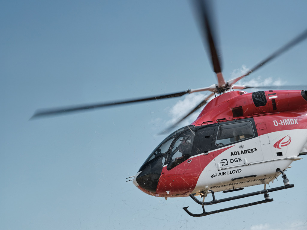
Detecting methane from a helicopter flying at 150 kilometres per hour might sound like science fiction, but laser-based methane detection makes it not just possible, but remarkably precise. As gas infrastructure operators face tightening environmental regulations and growing pressure to reduce emissions, understanding the technology behind airborne gas leak detection has never been more relevant. This article breaks down how laser-based methane detection works, what makes it so accurate, and why it represents a genuine step forward for pipeline inspection.
What is laser-based methane detection and how does it work?
Laser-based methane detection is a remote sensing technology that identifies the presence of methane gas by analysing how laser light interacts with the atmosphere. When laser pulses travel through air containing methane, the gas absorbs a portion of the light at specific wavelengths. By measuring how much light returns to the sensor, the system can determine whether methane is present and at what concentration, all without any physical contact with the gas itself.
The most advanced implementation of this principle is the Differential Absorption LIDAR method, commonly known as DIAL. A DIAL system emits two laser pulses at slightly different wavelengths: one that methane absorbs strongly, and one that passes through almost unaffected. Comparing the return signals from both pulses reveals the methane concentration along the laser path with exceptional sensitivity. When mounted on a helicopter, this technology transforms into a powerful aerial survey tool capable of scanning large stretches of gas infrastructure quickly and efficiently.
The scanning system does not simply fire a single beam downward. It sweeps across a wide strip on either side of the pipeline, building up a dense grid of individual measurement points. This grid-based approach is essential because underground gas leaks do not always emerge directly above the pipe. Gas travels through soil, and the resulting surface plume can be displaced several metres from the actual leak location, making wide scan coverage critical for reliable detection.
Why is the DIAL method more precise than traditional gas detection?
Traditional gas detection methods, such as handheld flame ionisation detectors or vehicle-mounted sensors, measure methane concentration at a single point in the atmosphere close to the ground. They are effective for targeted searches but slow, labour-intensive, and limited in spatial coverage. A technician walking a pipeline route on foot can cover only a few kilometres per day, and the results depend heavily on wind conditions and the inspector’s path.
The DIAL method overcomes these limitations through several distinct advantages. First, it operates at the 3.3 micrometre mid-infrared wavelength, the range where methane molecules absorb laser light most strongly. This makes the measurement inherently selective: the system responds to methane specifically, reducing false positives from other gases. Second, because the technique compares two simultaneous laser pulses, it is self-referencing. Atmospheric scattering, turbulence, and variations in surface reflectivity affect both pulses equally, so their influence is cancelled out in the final calculation, leaving a clean methane signal.
Third, the DIAL approach delivers a path-integrated measurement. Rather than sampling a tiny volume of air at one location, each measurement point represents the total methane column along the entire laser path from the helicopter to the ground and back. This makes the system sensitive to even thin layers of gas dispersed over a wide area, which is exactly the condition you encounter when a small underground leak diffuses through soil before reaching the surface.
For pipeline operators exploring airborne pipeline inspection services, understanding this distinction matters. The physics of the DIAL method produce a fundamentally more reliable result than point-sampling approaches, particularly for underground infrastructure where gas plumes are diffuse and unpredictable.
How small a gas leak can airborne laser detection actually find?
This is one of the most practical questions pipeline operators ask, and the answer depends on both the technology’s sensitivity and the physical behaviour of underground leaks. Research from institutions including the Engler-Bunte Institute demonstrates that underground gas emissions form wider plumes above ground. The gas travels laterally through soil before surfacing, and once in the air it is quickly diluted by wind. For a detection system to be reliable, it must be sensitive enough to catch this diluted signal under real operating conditions.
Certified performance specifications for the most advanced airborne LIDAR methane detection systems include the following capabilities:
- A per-point detection limit of less than 1 ppm·m (parts per million metres), meaning the system can detect extremely thin concentrations of methane integrated over the laser path
- A sampling rate of 1,000 measurements per second, building up a dense, high-resolution dataset across the entire scan swath
- A measurement spot diameter of 80 to 150 centimetres depending on flight altitude, giving spatial resolution fine enough to pinpoint anomalies accurately
- Independently verified surface sensitivity of 300 ppm in a 2 by 2 metre area under all certified flight altitudes and allowable wind conditions
To put the 300 ppm figure in context: at the physically smallest detectable leak in high-pressure steel pipelines, approximately 300 ppm of methane was measured directly above the pipeline route during certification testing. The system is therefore calibrated to the real-world minimum signal that an actual underground leak produces, not an abstract laboratory threshold. Leakage rates of around 150 litres per hour can be registered at wind speeds of up to 24 km/h, making the technology genuinely useful under typical field conditions.
What factors affect the accuracy of methane detection from a helicopter?
Precision in airborne gas leak detection is not just a matter of sensor sensitivity. Several operational and environmental factors determine whether a survey delivers reliable, actionable results.
Flight altitude and speed
Flying higher increases the measurement spot diameter, which reduces spatial resolution. Flying too fast reduces the number of measurement points per metre of pipeline. Certified airborne LIDAR systems operate within defined altitude bands, typically 100 to 180 metres, and speed ranges up to 165 km/h, balancing coverage rate with measurement density. Documented compliance with these operational limits is a quality assurance requirement, not just a recommendation.
Wind conditions
Wind disperses surface methane plumes and carries them away from the leak location. Higher wind speeds reduce the concentration that the sensor measures above a given leak. This is why certification standards specify maximum allowable wind speeds, and why sensitivity must be substantially better than the minimum detection threshold to remain reliable across the full range of permitted conditions.
Positional accuracy and pipeline tracking
Even with a highly sensitive sensor, measurements are only useful if they are taken in the right place. Aircraft roll movements can shift the scan path away from the pipeline without the crew noticing. Active pipeline tracking systems that continuously monitor and correct the scan position, keeping the measurement centreline within 0.5 metres of the pipeline, are essential for verified coverage. Geo-referenced localisation of findings to better than 2 metres ensures that any anomaly can be handed off to a ground crew with a precise location for follow-up investigation.
Scan swath width
A single line of measurement points directly above the pipeline is not sufficient. Because underground plumes can emerge up to 10 metres or more from the pipe centreline, reliable detection requires a measurement grid extending at least 10 metres on either side of the pipeline with spatial resolution better than 2 metres. Systems that produce only a narrow track of data along the pipeline route will miss real leaks that surface away from the centreline.
How does laser methane detection comply with EU methane regulations?
The EU Methane Regulation (2024/1787) introduced a structured framework for Leak Detection and Repair programmes covering gas pipelines and other infrastructure. The regulation distinguishes between two inspection classes with different sensitivity requirements and monitoring intervals.
Type-1 inspections require a detection limit of 17 g/h or 7,000 ppm, a level achievable with optical gas imaging cameras or less sensitive handheld equipment. Type-2 inspections demand a detection limit of 5 g/h or 1,000 ppm, requiring considerably more sophisticated technology. In return for meeting the higher sensitivity requirement, operators using Type-2 certified technology can inspect underground pipelines once every three years rather than more frequently. This structure creates a direct economic incentive to invest in better detection capability.
For aerial platforms to qualify as Type-2 inspection tools, they must demonstrate that their per-point sensitivity is reliably better than the 1,000 ppm threshold under all allowable conditions, not just in ideal circumstances. Because methane plumes are diluted before they reach the sensor, the system’s verified surface sensitivity must be well below the threshold to guarantee reliable detection across all permitted flight altitudes and wind speeds. A surface sensitivity of 300 ppm, verified independently according to the DVGW G465-4-5 standard, provides the margin needed to comply with Type-2 requirements under real operating conditions.
The regulation also defines a two-step LDAR methodology. Step 1 is surface screening, identifying locations that warrant further investigation. Step 2 is source confirmation after excavation or bar-hole drilling, which triggers the repair obligation when the 1,000 ppm threshold is confirmed at the source. Airborne laser detection operates as a high-efficiency Step 1 tool, delivering GPS-tagged anomaly reports that direct ground crews to specific locations rather than requiring them to walk entire pipeline routes. This dramatically reduces the cost and time of the overall inspection programme.
Operators who established their LDAR plans and conducted their first Type-2 surveys by the August 2025 deadline will already be familiar with how airborne methane monitoring technology fits into this framework. For those still structuring their programmes, understanding the distinction between Type-1 and Type-2 requirements is the starting point for choosing the right inspection approach. You can learn more about the regulatory context and available inspection options on the ADLARES website.
How ADLARES helps with laser-based methane detection
We at ADLARES have spent over two decades developing and operating the most certified airborne methane detection technology available. Our CHARM® system is the world’s only DVGW-approved aerial gas remote detection system, and it is fully Type-2 compliant under the EU Methane Regulation. To date, we have inspected more than 250,000 kilometres of gas pipelines across Europe for grid operators who need reliable, regulation-ready results.
When you work with us, here is what you get:
- Certified DIAL technology operating at 3.3 micrometre mid-infrared, with a verified surface sensitivity of 300 ppm in a 2 by 2 metre area under all flight conditions
- Full scan swath coverage of 24 to 25 metres width, ensuring no underground plume is missed due to lateral displacement from the pipeline
- Active pipeline tracking with less than 0.5 metre deviation from the centreline and georeferenced findings accurate to better than 2 metres
- Type-2 LDAR compliance out of the box, supporting your three-year inspection interval and full EU Methane Regulation reporting obligations
- Secure Web GIS delivery of survey results, accessible on desktop and mobile so your team can verify and act on findings immediately
If you are planning your next pipeline inspection campaign or structuring your LDAR programme, we would be glad to discuss how our airborne methane detection services can meet your specific requirements. Get in touch with our team today to find out how we can help you inspect faster, comply confidently, and reduce emissions effectively.
Dieser Inhalt wurde mithilfe von KI erstellt und kann Fehler enthalten.