Aerial methane detection surveys, including helicopter and drone-based systems, are generally more accurate and comprehensive than traditional ground-based methods for large-scale pipeline and facility inspections. They cover far more ground in less time, detect leaks that ground crews might miss due to terrain or access limitations, and increasingly meet the precision standards required under the EU Methane Regulation. The sections below unpack the key questions operators ask when comparing these approaches.
Which detection method finds more leaks: aerial or ground surveys?
Aerial surveys typically find more leaks across large infrastructure networks because they can cover hundreds of kilometres in a single flight without the access limitations that slow down ground teams. Ground-based surveys are thorough at the component level but depend heavily on technician proximity, terrain accessibility, and available time. For extensive pipeline corridors, aerial methods consistently achieve broader coverage with fewer missed areas.
Ground-based leak detection, such as walking surveys with handheld flame ionization detectors or vehicle-mounted sensors, excels at close-range inspection of individual components. Technicians can pinpoint a leaking valve or fitting with high precision. However, this granularity comes at a cost: ground surveys are slow, labour-intensive, and often impractical across remote or difficult terrain.
Aerial surveys operate at a fundamentally different scale. A helicopter equipped with a laser-based sensor system can inspect tens of kilometres of pipeline per hour, scanning the entire right-of-way rather than spot-checking accessible points. This wide-area coverage means fewer leaks go undetected simply because a crew never reached that section of the network. For operators managing large transmission or distribution networks, the detection completeness of aerial surveys is a significant advantage when measuring methane emissions across an entire asset portfolio.
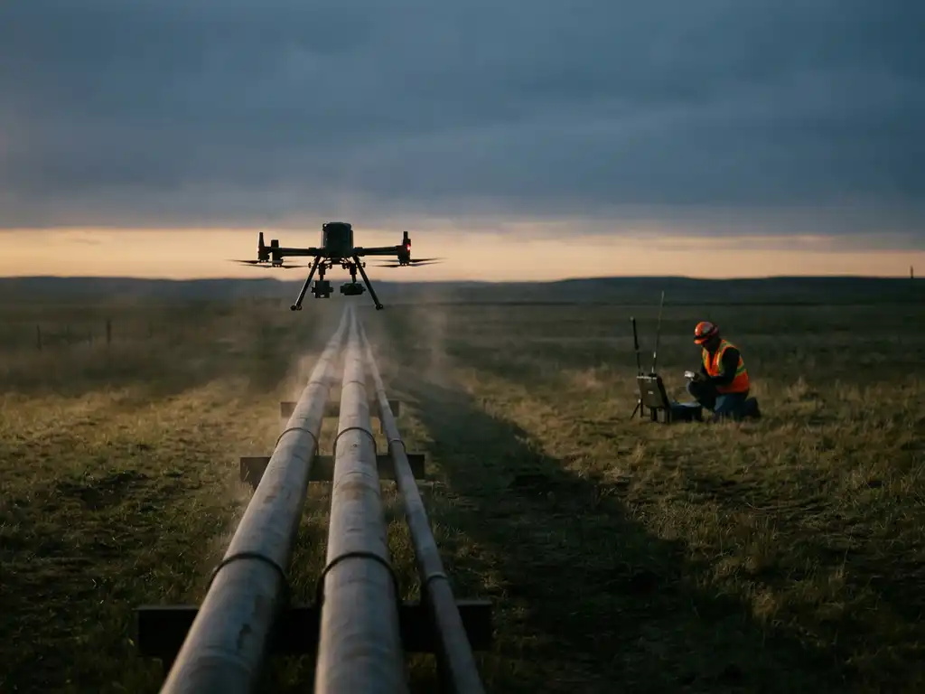
How sensitive are drone and helicopter methane sensors?
Modern airborne methane sensors are highly sensitive, capable of detecting very small leak rates even at survey speeds and altitudes that would seem to preclude fine measurement. Helicopter-mounted laser systems using Differential Absorption LIDAR (DIAL) technology can register leakage rates as low as 150 litres per hour at wind speeds up to 24 km/h, flying at altitudes of 100 to 150 metres and speeds of up to 180 km/h.
This sensitivity level is significant in practical terms. Many real-world leaks in gas distribution networks fall at or near this threshold, meaning a well-calibrated airborne system will flag leaks that a ground survey might classify as background noise or simply not encounter. The measurement rate of advanced systems, reaching 1,000 measurement points per second, creates a dense data grid across the surveyed corridor rather than a series of discrete spot measurements.
Drone-based sensors vary more widely in sensitivity depending on the sensor technology deployed. Smaller drones often carry optical gas imaging cameras or electrochemical sensors, which are less sensitive than DIAL-based systems but useful for close-range facility inspections where flight altitude and speed can be tightly controlled. For pipeline-scale surveys requiring the highest sensitivity, helicopter-mounted DIAL systems currently represent the most capable option available commercially.
What factors affect the accuracy of aerial methane surveys?
The accuracy of an aerial methane survey depends on wind conditions, flight altitude and speed, sensor technology, and atmospheric stability. Wind speed and direction are the most critical variables: methane plumes disperse rapidly in high winds, which can dilute concentrations below detectable thresholds or shift the plume away from the flight path. Surveys conducted in calm to moderate wind conditions produce the most reliable results.
Flight parameters also matter considerably. Flying too high reduces the concentration of methane reaching the sensor; flying too low increases turbulence and limits the swath width covered per pass. Experienced operators calibrate altitude and speed to the specific sensor system and terrain to maintain optimal detection conditions throughout the survey.
Atmospheric stability influences how methane plumes behave. Thermal inversions can trap gas near the ground and actually enhance detection, while highly convective conditions cause rapid mixing that disperses plumes before they can be measured. Survey scheduling that accounts for seasonal and daily atmospheric patterns improves data quality substantially. Finally, the quality of the underlying sensor technology, its calibration state, and the post-processing algorithms applied to raw data all contribute to how accurately the survey translates raw measurements into actionable leak indications.
Can aerial surveys quantify emission rates, or just detect leaks?
Advanced aerial surveys can do both: detect the presence of a methane leak and quantify the emission rate at the site level. DIAL-based airborne systems measure the column concentration of methane across a cross-section of the plume, and when combined with wind speed and direction data, this allows operators to calculate the mass flow rate of methane escaping from a facility or pipeline segment.
This quantification capability is critical for compliance with the EU Methane Regulation, which requires operators not only to identify leaks but to report emission quantities at the source and site level. Aerial emission quantification, sometimes called methane emission quantification, bridges the gap between detection and regulatory reporting by producing the numerical emission estimates that verification bodies and regulators require.
It is worth noting that aerial quantification operates at the site or segment level rather than the individual component level. A helicopter survey can tell an operator that a compressor station is emitting a certain volume of methane per hour, but it will not specify which individual valve or seal is responsible. That component-level attribution still requires follow-up ground inspection. Aerial and ground methods are therefore complementary rather than mutually exclusive in a complete methane emission factor assessment programme.
When should operators choose ground methods over aerial surveys?
Ground methods are the better choice when operators need component-level attribution, when the inspection area is small and densely packed, or when regulatory requirements specifically mandate close-range measurement techniques. For individual facility audits, compressor station walk-downs, or detailed follow-up after an aerial survey has flagged a leak zone, ground teams with handheld or vehicle-mounted sensors provide the resolution that aerial systems cannot match.
Urban distribution networks with short pipe runs and frequent access points are another case where ground surveys remain practical. When a technician can walk the entire network in a day, the speed advantage of aerial coverage becomes less relevant. Ground methods are also preferred when weather conditions consistently prevent safe or accurate aerial operations, or when budget constraints limit the use of aircraft.
The most effective inspection programmes combine both approaches. An aerial survey establishes which segments of a large network require attention, narrowing the scope for ground crews, who then conduct targeted, efficient follow-up inspections. This tiered approach reduces the total cost and time of a comprehensive leak detection programme while maintaining the thoroughness that regulators and best-practice frameworks expect.
Do aerial methane surveys meet EU Methane Regulation requirements?
Yes, aerial methane surveys can meet EU Methane Regulation requirements, provided the technology used achieves the sensitivity thresholds specified for the relevant equipment category. The EU Methane Regulation 2024/1787 requires operators of fossil energy infrastructure to measure methane emissions regularly, quantify them at the source and site level, and report them annually with independent third-party verification. High-sensitivity airborne systems are explicitly recognised as capable of fulfilling the Type 2 requirements for underground equipment.
The regulation distinguishes between different equipment types and sets corresponding sensitivity requirements. Airborne DIAL systems that can detect leaks at or below the specified thresholds, and that produce quantified emission data suitable for annual reporting, satisfy the technical requirements of the regulation. Operators should verify that the specific system and service provider they engage can demonstrate compliance with the applicable sensitivity standards and that survey results are delivered in a format accepted by verification bodies.
Beyond technical sensitivity, regulatory compliance also requires proper documentation, data traceability, and the ability to demonstrate survey coverage across the full asset inventory. Operators using aerial survey services should confirm that results are delivered through a platform that supports audit trails, geographic coverage records, and structured reporting outputs aligned with the regulation’s annual reporting obligations.
How ADLARES helps operators measure methane emissions from the air
We provide operators with a complete aerial methane detection and quantification service built around our CHARM® technology, the world’s only DVGW-approved airborne gas remote detection system. Whether you need to survey hundreds of kilometres of transmission pipeline or quantify site-level emissions at a compressor station or landfill, we deliver the sensitivity, speed, and regulatory-grade data quality that the EU Methane Regulation demands.
- High-sensitivity detection: CHARM® uses the DIAL method to detect leakage rates from 150 l/h at flight speeds of up to 180 km/h, ensuring that small but significant leaks are not missed across large networks.
- Site-level emission quantification: Our surveys produce quantified methane emission data at the site and segment level, directly supporting annual reporting obligations under EU Methane Regulation 2024/1787.
- Regulatory compliance: CHARM® meets the EU Methane Regulation Type 2 sensitivity requirements for underground equipment, and our results are delivered through a secure Web GIS platform that supports third-party verification and audit documentation.
- Proven scale: With over 250,000 km of gas pipelines inspected across Europe since 2008, we bring extensive operational experience to every survey engagement.
- Complementary ground follow-up support: Our survey outputs are structured to guide efficient ground-based follow-up, so your teams can focus their time on confirmed leak zones rather than blanket inspections.
If you are preparing for your first compliance survey or looking to upgrade your existing LDAR programme, we are ready to discuss how our services fit your network and reporting timeline. Get in touch with our team to find out how ADLARES can help you meet your methane emission obligations with confidence.