
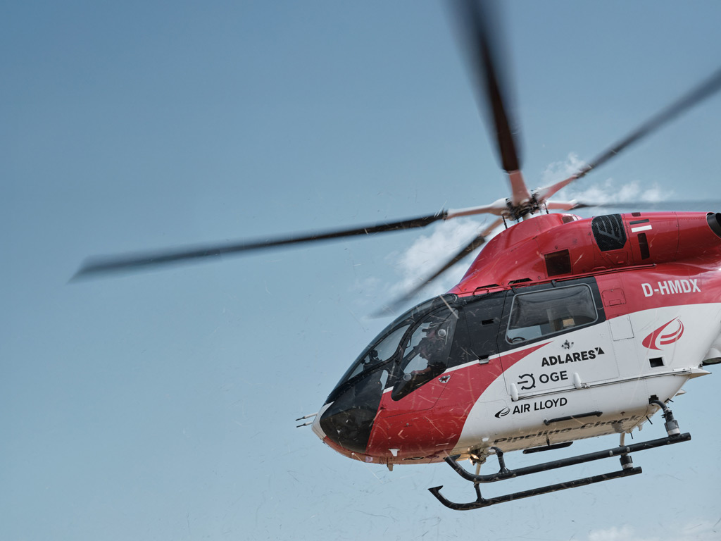
Natural gas pipelines form the backbone of Europe’s energy infrastructure, quietly carrying fuel to homes, businesses, and power stations across thousands of kilometres. Keeping that network safe and leak-free is not just a matter of operational efficiency; it is a legal obligation and an environmental responsibility. With the EU Methane Regulation now firmly in force, pipeline operators face stricter requirements than ever before when it comes to detecting and repairing leaks. Understanding how natural gas pipeline inspection works, and what the different methods can and cannot do, helps operators make informed decisions about the technology they rely on.
Why do natural gas pipelines need to be inspected?
Even well-maintained pipelines develop leaks over time. Ground movement, corrosion, joint degradation, and third-party damage can all create small openings through which methane escapes. Methane is a potent greenhouse gas, and uncontrolled emissions from gas infrastructure contribute meaningfully to climate change. Beyond the environmental dimension, leaking gas represents lost product and, in some circumstances, a safety hazard.
Regulatory pressure has intensified significantly. The EU Methane Regulation (2024/1787) requires pipeline operators to establish formal Leak Detection and Repair (LDAR) programmes covering underground pipelines and above-ground infrastructure, including compressor stations and measurement stations. Operators were required to initiate their first Type-2 LDAR survey by August 2025. The regulation distinguishes two inspection classes:
- Type-1 inspections require a detection threshold of 17 g/h (or 7,000 ppm local concentration) and are suited to optical gas imaging cameras and handheld equipment used at close range.
- Type-2 inspections require a far more sensitive threshold of 5 g/h (or 1,000 ppm local concentration) and demand more sophisticated technology.
The regulation is structured to reward investment in better technology: operators who use Type-2 compliant systems can inspect underground pipelines once every three years rather than more frequently. This makes the choice of inspection method a genuinely strategic decision, not just a technical one.
What methods are used to inspect natural gas pipelines?
Several approaches exist for gas pipeline leak detection, each suited to different contexts and sensitivity requirements.
On-foot surveys with handheld equipment
Technicians walk the pipeline route carrying flame ionisation detectors or catalytic sensors, sampling air close to the ground. This method is thorough but extremely slow and labour-intensive. It is practical for short sections or dense urban networks but becomes prohibitively expensive across long rural pipelines.
Vehicle-based surveys
Instruments mounted on vans or trucks can cover pipeline routes faster than walking crews. Mobile laser-based sensors have improved the sensitivity of vehicle surveys considerably, but vehicles are limited to accessible roads and cannot always follow the exact pipeline corridor.
Airborne surveys
Fixed-wing aircraft and helicopters equipped with laser sensors can survey hundreds of kilometres of pipeline in a single day. Airborne pipeline inspection services using LIDAR-based technology represent the fastest and most scalable approach to large-scale leak detection, and they are the only practical method for inspecting long, remote pipeline corridors efficiently.
Satellite-based monitoring
Satellites can detect large methane plumes from orbit, but their spatial resolution and sensitivity remain too limited to detect the small, individual leaks that pipeline LDAR programmes must find. Satellite data is better suited to identifying major emission events than to routine pipeline inspection.
How does airborne gas leak detection work?
Airborne methane leak detection using LIDAR technology relies on the physical property that methane absorbs laser light at specific wavelengths. The Differential Absorption LIDAR (DIAL) method fires two laser pulses of slightly different wavelengths from the aircraft. One wavelength is absorbed by methane; the other passes through largely unaffected. By comparing the reflected signals, the system calculates the concentration of methane in the air column below the aircraft with high precision.
The aircraft flies at low altitude, typically between 100 and 150 metres above ground, following the pipeline corridor. At this altitude and at survey speeds of up to 180 km/h, the sensor can collect a dense grid of measurement points across the pipeline route rather than a single line of measurements directly above the pipe.
This grid coverage is critical. Research from institutions including the Engler-Bunte Institute and METEC (Methane Emissions Technology Evaluation Center) has demonstrated that underground gas leaks do not always surface directly above the pipe. Gas travels through soil, and the resulting plume widens before reaching the surface, meaning a system that only measures directly above the pipeline centreline will miss a significant proportion of real leaks. Reliable detection requires a measurement grid extending at least 10 metres either side of the pipeline centreline, with spatial resolution better than 2 metres per measurement point.
What’s the difference between ground-based and aerial pipeline inspection?
The practical differences between ground-based and airborne pipeline inspection come down to speed, coverage, and the two-step structure that the EU Methane Regulation defines for underground LDAR.
Under the regulation’s two-step methodology, Step 1 is surface screening, which determines where a signal warrants further investigation. Step 2 is source confirmation, carried out after ground access has been opened through excavation or bar-hole drilling. The repair obligation is only triggered at Step 2, when the 1,000 ppm threshold is confirmed at the source.
Aerial platforms are highly efficient Step 1 screening tools. A single helicopter survey can cover hundreds of kilometres in a day, delivering GPS-tagged anomaly reports that tell ground teams exactly where to focus their Step 2 investigations. This dramatically reduces the total route length that on-foot crews need to walk, concentrating manual effort on confirmed anomaly zones rather than entire pipeline corridors.
Ground-based surveys, whether on foot or by vehicle, are better suited to Step 2 confirmation work, dense urban networks where low-altitude flight is restricted, or situations where aerial access is not possible. The two approaches are complementary rather than competing alternatives.
How accurate is remote methane detection from a helicopter?
The accuracy of any airborne LIDAR pipeline inspection system depends on three factors working together: sensor sensitivity, spatial coverage, and verified measurement positioning.
Sensor sensitivity alone is not sufficient. A system must also demonstrate that its measurements are actually taken across the full pipeline corridor, not just along a narrow track above the centreline. Positional deviation due to aircraft roll movements is a real risk in aerial surveys, which is why credible systems include active pipeline tracking and in-flight verification that every section of the route has been covered in a proper measurement grid.
The world’s only technical standard for aerial inspection of underground gas pipelines, DVGW G465-4-5 (formerly G501), sets binding requirements that address all three factors. It requires a minimum detection threshold of 150 l/h (approximately 110 g/h methane), a detection probability of at least 80% demonstrated across five flyovers, and documented compliance with binding operational limits for altitude, airspeed, and wind speed. Crucially, certification under this standard is not based on ideal laboratory conditions; it reflects real-world operating performance within defined limits.
For Type-2 LDAR compliance under the EU Methane Regulation, the sensitivity bar is even higher: 1,000 ppm local concentration or 5 g/h emission rate. To reliably meet this threshold under all allowable environmental conditions, a system’s verified sensitivity should be at least three times better than the required level.
How are pipeline inspection results reported and acted on?
A pipeline safety inspection only delivers value if its findings reach the right people quickly and in a format that enables action. Good reporting practice distinguishes between findings that require immediate attention and those that can be scheduled for routine follow-up.
Critical findings, such as significant active leaks, should be communicated as quickly as possible after the flight, ideally within hours of landing. Standard gas reports covering the full survey should follow within a defined timeframe, typically around ten working days after the flight is completed. Sections where survey conditions fell outside the certified operational limits should be documented separately, with re-inspection scheduled until those sections are cleared.
Each individual gas finding report should include a map showing the pipeline route and the pinpointed leak position, GPS coordinates, an aerial photograph with measurement overlay, a detailed location photograph, and wind conditions at the time of detection. This level of detail allows ground teams to locate and investigate the anomaly efficiently without ambiguity.
Beyond individual leak reports, operators also need documentation of sections where the survey could not be completed under required conditions, so that gaps in coverage are transparent and can be addressed. All records must be retained for at least ten years under EU Methane Regulation requirements.
How ADLARES helps with natural gas pipeline inspection
We developed and operate CHARM, the world’s only DVGW-certified airborne gas remote detection system, specifically to meet the demands of large-scale pipeline inspection at the highest level of accuracy. Since 2008, we have inspected over 250,000 km of gas pipelines for grid operators across Europe, and our service is built around the principle that every kilometre counts.
Here is what working with us looks like in practice:
- Type-2 LDAR compliance: CHARM is certified as Type-2 compliant under EU Methane Regulation 2024/1787, meeting the 5 g/h and 1,000 ppm detection threshold, which qualifies your underground pipelines for the three-year inspection interval.
- Full-service delivery: We do not just supply data. Our flight operations team ensures every kilometre is inspected within DVGW G465-4-5 certified conditions, and out-of-spec sections are re-flown until cleared. A dedicated data crew reviews every finding, filtering out non-relevant emissions from neighbouring sources such as biogas facilities or wastewater plants.
- Fast, actionable reporting: Critical findings are forwarded within 12 hours of landing. Standard gas reports follow within 10 working days, delivered via a secure Web GIS platform accessible on desktop and mobile devices.
- Verified position quality assurance: Every survey includes active pipeline tracking, in-flight grid coverage verification, and documented compliance with all operational limits, so you have full confidence that the inspection has actually covered your infrastructure.
- Europe-wide operations: General approvals for flights in Germany are already in place. For operations in other countries, we coordinate the necessary permits with you in advance.
If you are preparing your LDAR programme or want to understand how CHARM can meet your inspection obligations efficiently, visit our website or get in touch with our team to discuss your pipeline network and survey requirements.
Dieser Inhalt wurde mithilfe von KI erstellt und kann Fehler enthalten.